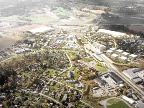
C.F. Møller-led team with JaJa architects, Rejlers and TØI (Institute of Transport Economics) has finalized a new urban centre masterplan for the Norwegian municipality of Vestby. Vestby is the administrative heart of the municipality, and is strategically located where the railroad meets motorway E6.
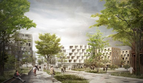
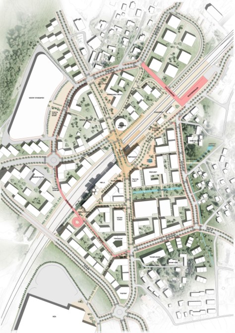
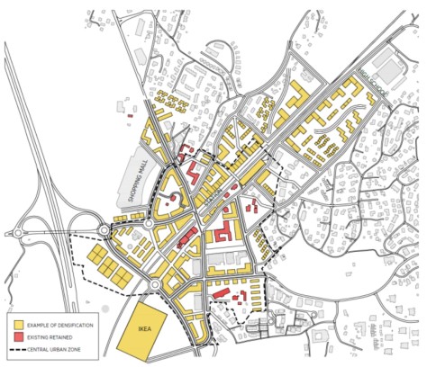
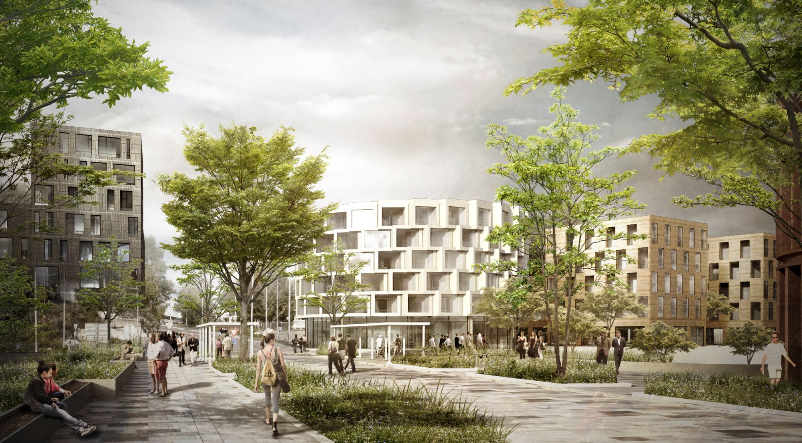
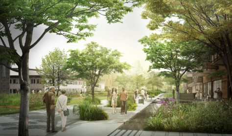
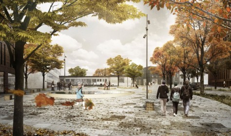
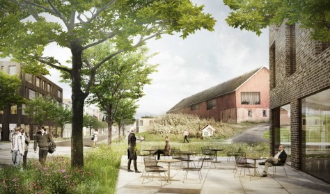
But the centre of Vestby is currently also dominated by car-based commercial space and its associated large parking spaces, and is perceived by many as a dull place lacking in identity. The proposal uses a number of measures to visualise an overall plan to resurrect the centre of Vestby, with attractive green streets and urban spaces, and a varied range of service, commercial and cultural opportunities.
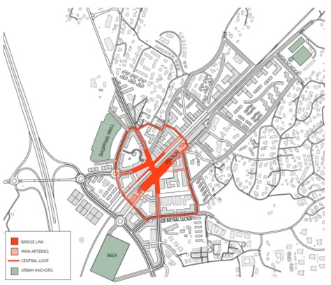
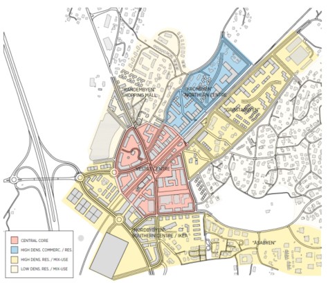
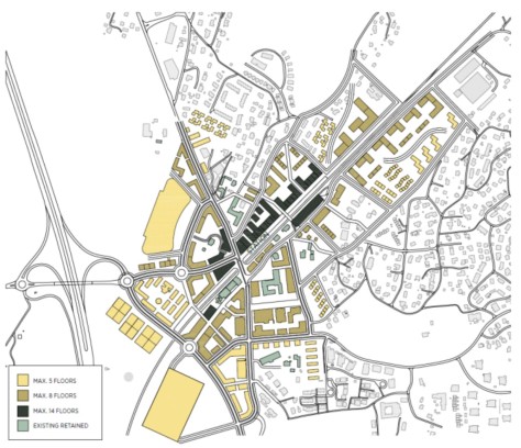
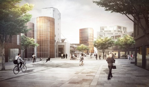
Bridge and Loop Vestby was founded in the infancy of mass private transport, resulting in urban spread and the death of the town centre. The aim has been to create a single Vestby centre with a consistent urban structure between the station area, Vestby Shopping Mall and IKEA. Vestby Centre will gain a distinct hub at the station, with a new and expanded bridge link across the track.
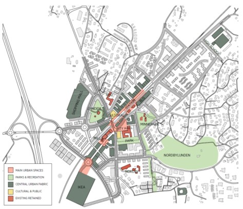
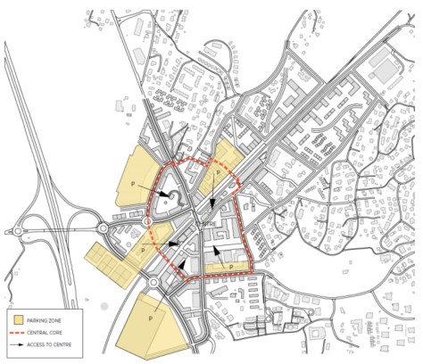
The bridge will be established as a green and sunny central square with benches, views and a walkway to the platforms. This will increase consistency and reduce the barrier between the northern and southern parts of the town. The project introduces a “Vestby loop”: a ring road that defines the heart of the town, creating new connections across the railway line.

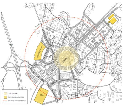
The loop is for pedestrians and cyclists, while vehicles will have access to parts of the loop from the main road system. Surveys show that 10,000 residents within walking distance is the critical limit for a living urban centre with a variety of facilities. With a clearly defined hub at Vestby station, the proposal is to construct 3,000 new homes in the centre and to establish streets and paths for pedestrians and cyclists, with the aim of ensuring a living urban centre, with more people and functions linked closely together.

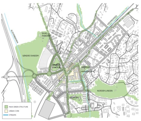
The healthy city Vestby thus becomes one of the first cities where the station area constitutes the city’s ‘main street’ accommodating offices, businesses, shops and services as well as a mix of residential. The proposal has focused on street sections and the infrastructure of the new plan, focusing on how to turn the current large-scale roads into attractive streets and urban spaces, and convenient connections to public transport as well as a clear priority of pedestrian and bicycle traffic are creating the foundation for a healthy city.
The team was selected for the commission by the municipality of Vestby in 2015, from a number of proposals. There is great potential for densification of the downtown core: In the Oslo and Akershus region, there will according to the forecasts be 1.5 million people in 2030, i.e. more than 400,000 new residents.

Oslo’s surrounding areas must take part in that growth, to focus it on existing towns and public transport nodes. The Vestby municipality is the municipality in the Oslo and Akershus that has seen the largest proportionate growth, with a rise of 3.1% in 2012. Source by C.F. Møller Architects.
Location: Vestby, Akershus, Oslo, Norway
Architecture/urbanism: C.F. Møller Architects, JaJa architects
Engineering: Rejlers
Traffic planning: TØI (Institute of Transport Economics)
Client: Vestby Municipality
Area: 27 ha
Year: 2015-2016
Images: Courtesy of C.F. Møller Architects