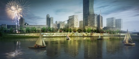
The Copa Cagrana Quai on the Danube Island presents a fantastic opportunity for the creation of an important piece of the urban realm in Vienna. The adjacency to the UN City and the new DC towers and the area of dense urban structure surrounding it, plus the new desirability of residential quarters along the river, and the fantastic level of accessibility which is provided by public transport, suggests that this could become one of the most significant riverfront locations in Vienna in the future.


Our proposal aims to address a number of opportunities operating on different scales:
1. The general demand for densification in cities, and the use of brownfield sites, and the desirability of the riverfront locations is growing.
2. The Copa Cagrana site lies right next to the Donauinsel U1 underground station, and the landing of the Reichstagsbrücke Bridge, which provide excellent mass transit to the site.
3. The Copa Cagrana site is exposed to heavy winds and periodic floods that have traditionally prevented a more intense form of urban development close to the river edge.

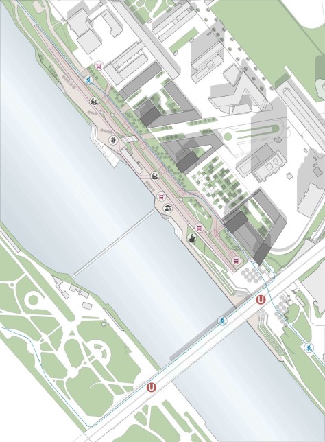
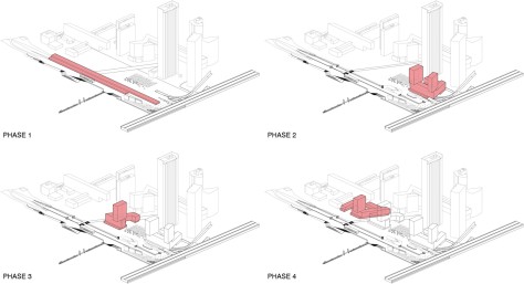
Masterplan Structure
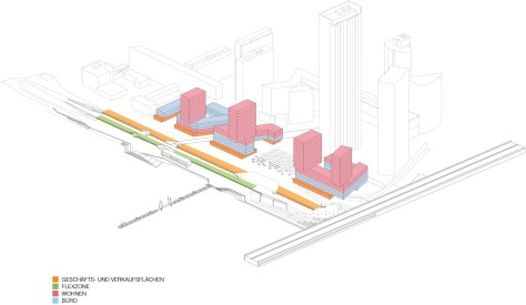
– Zone C. Corresponds to the area occupied in plan by the Donauuferautobahn A22 Tunnel, has been designed to withstand building loads equivalent to 7 floor height buildings. We have designed the fabric to cover the entire width of the tunnel, plus a band of 24.3m to the south, with a zone of semi-closed blocks which will enclose open public spaces which will protect public space from the strong winds in the area. These spaces will form a sequence of semi-enclosed public spaces with an adequate urban environment, which will accommodate hybrid programs.


The height of most of the development will be around 7 floors, with a maximum cornice level of 26,40m, which can only be exceeded on the band on zone B, which can be grounded outside of the tunnel. On this band we have located 4 towers with a relatively small footprint and oriented perpendicular to the main Southwest wind direction in order to reduce downdraft. It is likely that the towers will be for residential use. The semi-closed blocks are provided with a projected socle, 8,1m towards the riverfront, in order to break the potential downdraft resulting from the buildings. The total amount of construction on this phase is 79,000m2.

– Zone B. On zone B we have tried not to extend over this area too much, to leave a 16.2m band of natural soil, where large evergreen trees will be planted in order to diminish the wind speeds along the riverfront. The landscaping on this zone will include as much green soil as possible in order to retain the rainwater locally, to produce the humidification of the air.


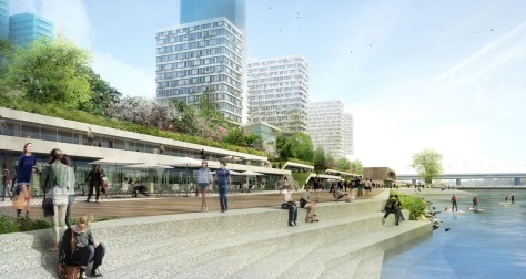
The southern part of Zone B will also be occupied by a band of retail program, 15.5 deep, accessible from a platform located at level +6. This program implies a total area of 4000m2, where the catering business that are no gathered haphazardly on the Copa Cagrana site will be hosted in an organized manner, above the 100 year flood plane, as an integral part of the new topography which will connected smoothly the +10m level, with the riverfront level at +2m.


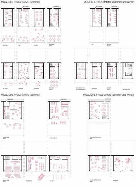
– Zone A. On Zone A we have located 5750 m2 of additional leisure oriented program, accessible from the quay level at +2m. Given the flood risks on this level, we are proposing to locate program which is either complementary to the one located at +6 —such as the case already happening in the newly built restaurant facility on the site— or devoted to functions which do not require delicate infrastructure: public toilets for the riverfront promenade, dressing rooms for sports, weights and sports facilities, hammocks and rowing boat rentals, Tai-Chi training, ice-skating, life-guarding facilities, children’s playgrounds… but also additional seats for bars or restaurants during the summer.

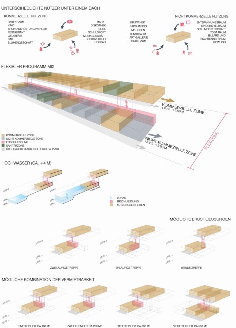
The +2 platform will provide an ideal location for facilities which can be easily stored in waterproofed storage. The public space will be organized in three levels with distinct qualities which gradate both topographically, programmatically and environmentally between the UN City and the DC tower zone to the water level. The three platforms that structure the public space are then connected through a number of ramps, stairs and mechanical devices which will facilitate the movement from the urban level at +10,00 to the quay level at +2,00:

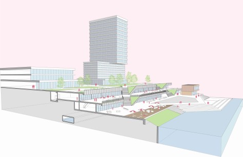
– Level +2,00 is the level of the quay. The modification will be mostly on the re-paving of the ground, sometimes with pre-cast tiles and sometimes with wooden decks and functions that include public activities in the park.
– Level +6,00 is the level above the 100-year flood plane. A new reinforced concrete structure will be built to cover the more public functions below to host all the different facilities which are now sitting on the quay, which will be ordered within a consistent glass façade.


– Level + 10,00 is the level where the DC Towers and the other mix-use buildings are located, On this level we have been mainly concerned with spreading the public activities and producing an adequate urban microclimate. This is the area where we will plant large evergreen trees along the waterfront for diminish the speed of wind in order to profit from rainfall on the buildings and the hinterland, keeping the hygrometric levels. Source by AZPML.


Location: Vienna, Austria
Architects: AZPML + SHARE Architects + YEWO Office
Team AZPML: Alejandro Zaera-Polo, Maider Llaguno, Guillermo Fernandez-Abascal, Manuel Eijo, Ivaylo Nachev, Maria Spada
Team SHARE architects: Thomas Lettner, Silvia Forlati, Hannes Bürger, Beatrice Broso, Stefania Catania, Giacomo Zanin, Bruno Melis
Team YEWO Landscapes: Dominik Scheuch, Georg Auersperg
Team Traffix: Andreas Käfer, Katharina Horvath
Team Arcadis: David W. van Raalten, Johan Kabout Msc
Client: WGM – Vienna Water Management
Total Area: 93380m2
Year Competition: 2015
Visuallizations: SBDA and AZPML-SHARE-YEWO, Courtesy of AZPML