
In collaboration with the Municipality of Amsterdam, DELVA devised an urban plan for Strandeiland (the second phase of IJburg which will accommodate 8000 homes in the middle of the IJ river), and further elaborated the dynamics of the inland waterways of Strandeiland, ‘Het Oog’ (the Eye). The new innovative city park is an impressive 22 hectares. Het Oog is a large inland waterway, situated on top of the historic primeval channel of the IJ.
The inland water forms the link between the two neighborhoods that make up Strandeiland. The distinctive identities of the Pampusbuurt (formal and urban) and Muiderbuurt (informal and natural) are reflected in the rich variety of landscape typologies that will work together to form the structure of the (underwater) landscape park. Het Oog adds to the rich palette of landscapes that Strandeiland houses.
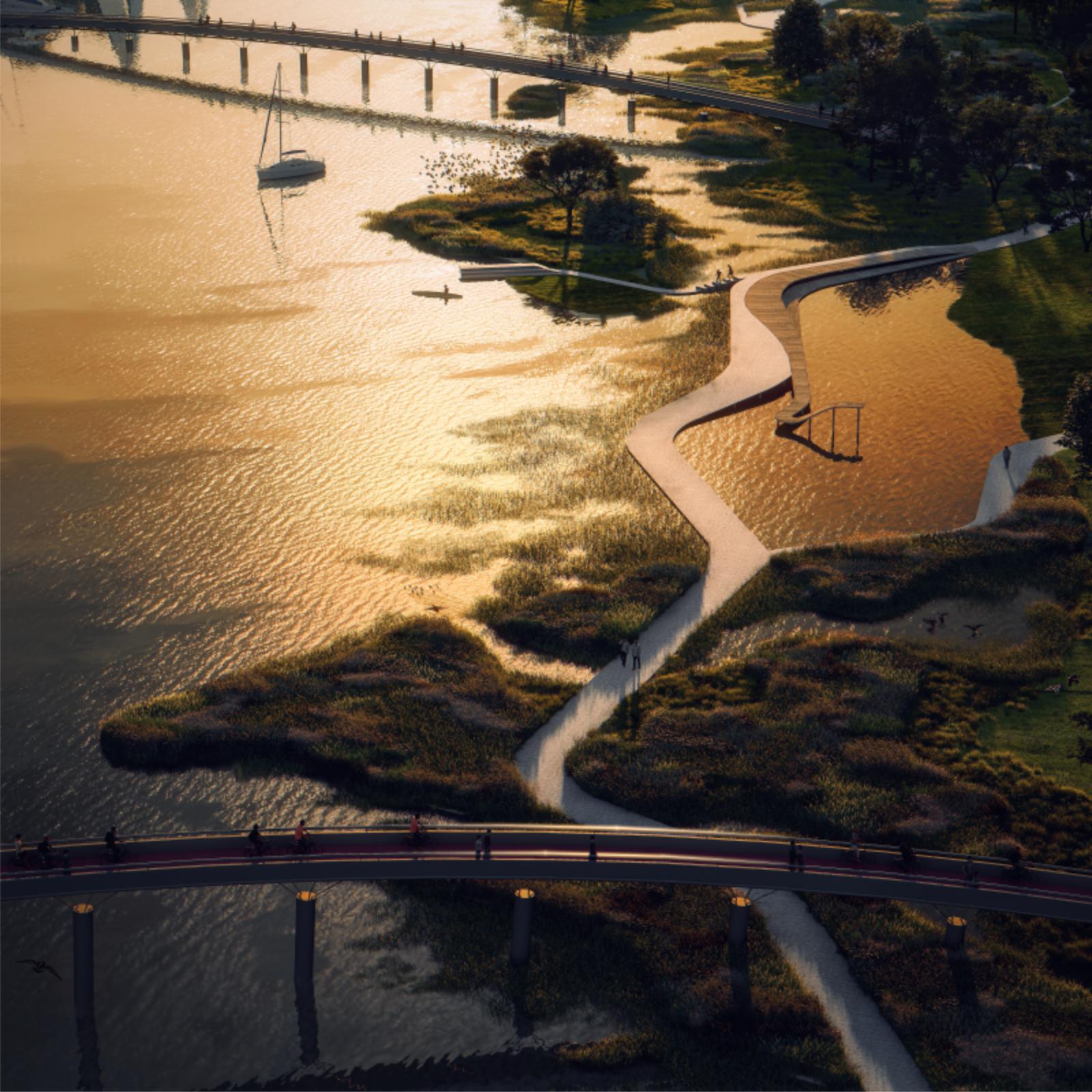
Image © WAX
It is a place of residence, meeting and activity for local residents but is also comprised of diverse ecosystems, a natural purification system and a distinct urban environment. Thus, Het Oog forms a solid ecological stepping stone between the IJmeer and the Diemerpolder. In addition, the inland water is not naturally formed and is completely manmade.
The identity of the park is derived from the inland water which serves the city and provides ecosystem services such as: improving water quality, water ecology and water recreation. Het Oog facilitates a particularly diverse water-related program in which the hard quay on the north side contrasts sharply with the soft bank on the south side. The southern side is being developed as a wide and varied natural bank where the maximum emphasis is placed on the following 3 themes:

Image © WAX
Water quality: natural purification of the rainwater
About half of the rainwater on Strandeiland is discharged via wadis and infiltration sewers into the inland water. This water contains a considerable amount of phosphorus and nitrates. Together, with the municipality of Amsterdam and Sweco, DELVA developed a toolbox to permanently guarantee improved and safe water quality levels. One strategy includes planting a large area of reed beds to inject additional levels of oxygen into the water.
Another strategy involves lowering the water level of the Eye so that the riverbed is exposed to sunlight which enables a rich variety of aquatic plants to thrive and assist in purifying the water in a natural way. By using artificial islands, wetlands and irregular landforms in the design, the bank length is drastically increased and assists in providing additional areas for the reed and underwater plants to flourish.

Image © WAX
Water ecology: a maximum variety of fauna and flora
The Eye is not only created for people, but also for plants and animals. Semi-wet environments such as banks for semi-submerged plants (reed beds, marsh plants and etc.) and underwater environments (garlands, fountain herbs and etc.). Large zones programmed with low-intensity recreation are created to allocate space for habitats for insects, small mammals, amphibians and birds among the rich variety of landscapes.
Water recreation: functions within a path structure
A broad spine runs along the entire expanse of the park and branches into narrower (and sometimes adventurous) side pathways that always offer different experiences. The design language consists of short, straight paths but are sometimes put at an angle and thus, creating a new perspective for visitors to be immersed in. Rest areas, seating and play elements provide space for water-related recreation and are all integrated within the same design language.
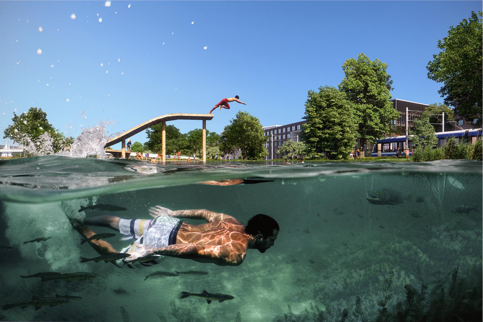
Image © WAX
Atmospheres within the plan
Quiet, natural zones alternate with lively and urban recreation areas on and around the (underwater) landscape. The parks (the green strips) in the Muiderbuurt- area are visually extended into the water. This location hosts the two largest recreation zones of the park, comprised of sunbathing areas, swimming facilities, jetties and adventure islands. The path structure takes people from west to east while experiencing different atmospheres.
In the west, it begins with a rougher and denser woody area that suddenly opens up to a natural swimming bay that shows the wide expanse and depth of the water. The main route continues over a wetland on the right and small reed islands on the left. Once under the bicycle bridge, you suddenly find yourself on the water between the high reeds, where open spaces with a view alternate with narrower spots where you feel completely enclosed.

Image © WAX
This is followed by a large, well-equipped swimming and recreation area with a diving board, a sunbathing area, a south-oriented sundeck that defines the swimming area, a shallow pool for smaller children and a mooring place for canoes. At the end, all the way to the east, in the middle of a rougher zone, you will find a seating tribune that looks out over the water towards the setting sun.
Future perspective
The sketch design for Het Oog is an elaboration of a part of the Manual Public Space Strandeiland and serves as the basis for the further development of the plan. Strandeiland is being developed in two phases: and currently the land mass of the first phase is already above water. The development is expected to be completed in 2040, and will then be home to 20,000 Amsterdammers living on the IJmeer. Source by DELVA

Master Plan
- Location: Strandeiland, Amsterdam, Netherlands
- Architect: DELVA
- Team: DELVA, Municipality of Amsterdam, Sweco
- Design team: Steven Delva, Emiel Swinnen, Thomas Wolfs, Ranee Leung, Sumanth Subbarao
- Client: Gemeente Amsterdam
- Area: 22 ha
- Year: 2020
- Images: WAX, Courtesy of DELVA

Pathways 
Pathways 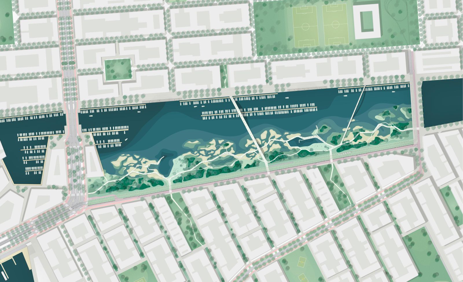
Plan 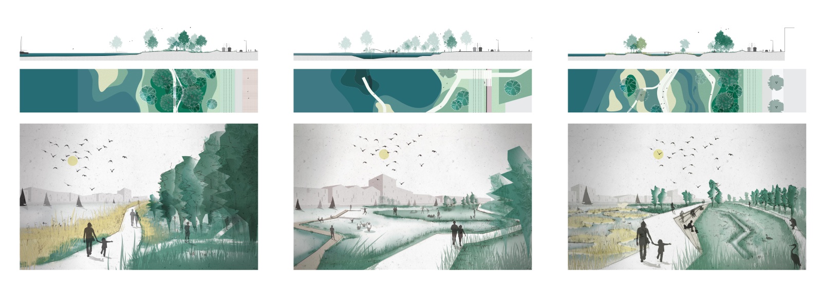
Landscape Scheme 
Landscape Scheme 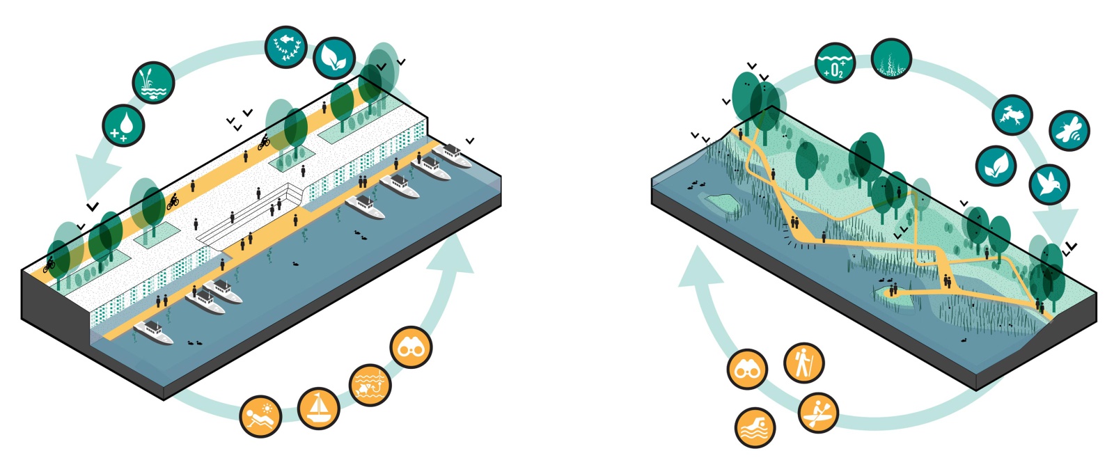
Scheme 
Pathways Scheme 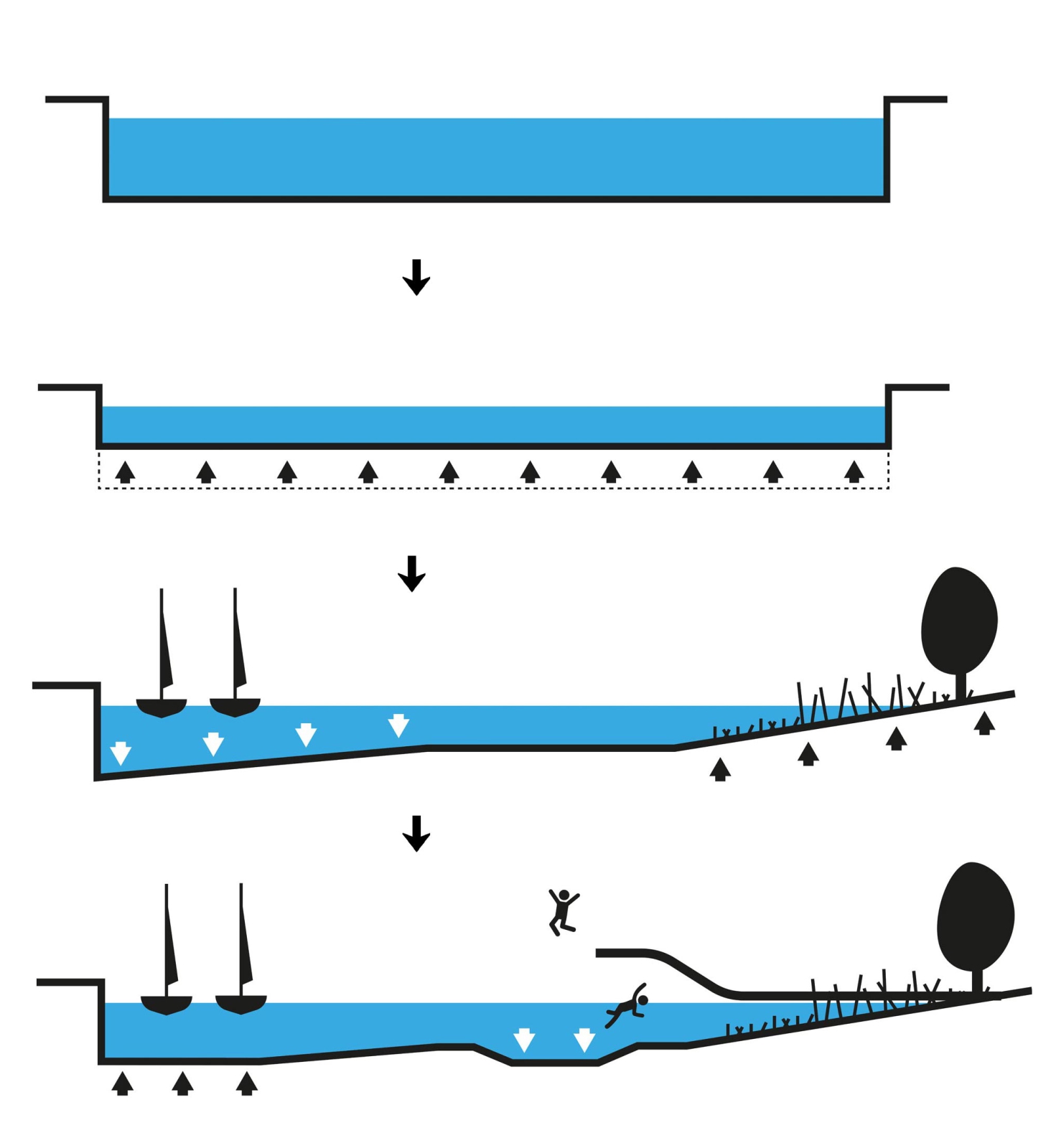
Sections Scheme 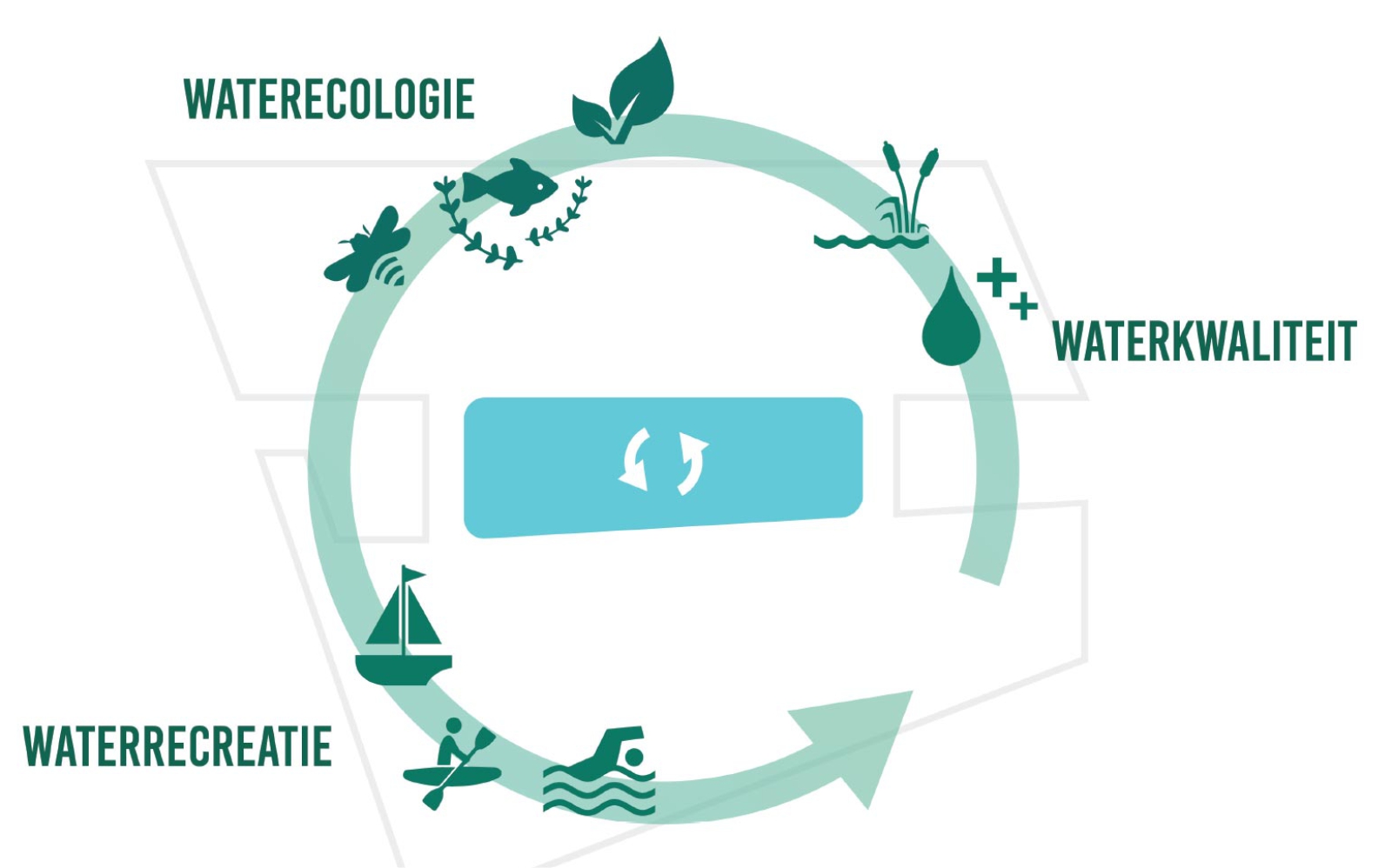
Scheme