
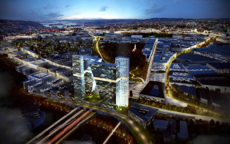
“Hovinbyen” is an area designated by the city council as the next growth area in Oslo. Today’s site is characterized by light industry and several main arteries that divides the area into sections, making infrastructure difficult for soft road users and a strong link to the inner city of Oslo. Our main idea was to problematize the whole concept of “Hovinbyen”. Rather than limit ourselves to a concept based on designing a new “town outside of the city”, we shifted our focus to cultivating local identities within the neighbouring areas and a stronger logistic connection to Oslo City Centre.

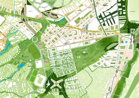
Context Oslo (of Latin: to weave together, relationships) proposes breaking down the major barriers that exist in the area today. Streamlined access within the area, and working with the residents to improve residents ‘ cognitive understanding of distances and orientation, are improvements we believe to be essential for a successful development develop of a compact and sustainable new area.

The main grip, therefore, was to work with a ribbon town stretching in two directions from the city centre, via the adjoining local focus areas, “Helsfyr”, “Økern”, “Bryn” and “Breivoll”, meeting where “Alnabruterminalen” meets the E18 motorway. The ribbon town would have a continuity along the local streets, urbanized by local trade, culture, and easy access to public transport, where people would travel intuitively. Source by Link Arkitektur.
Location: Hovinbyen, Oslo, Norway
Architects: Link Arkitektur
Year: 2015
Images: Courtesy of Link Arkitektur